Askja
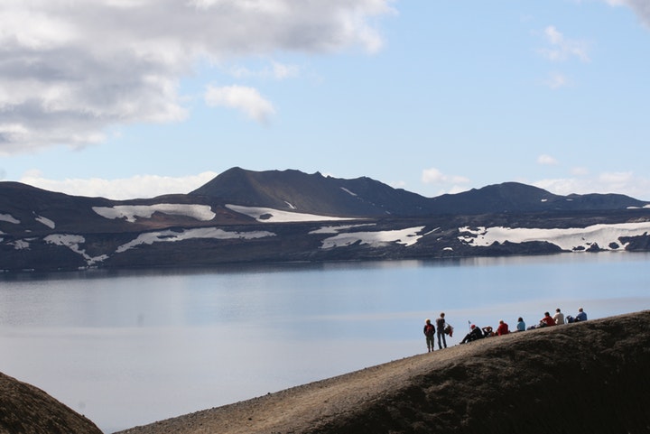
The Askja Lunar Tour has for many years been the most popular guided day tour from Lake Mývatn. The tour, which takes 11-12 hours, takes our passengers on 4×4 buses through Iceland’s largest wilderness. You will see various geological sites and marvels of nature, such as the spectacular lunar landscape where the American astronauts Neil Armstrong and Buzz Aldrin trained before they ventured to the moon in 1969. The tour also takes you to the Herðubreiðarlindir nature reserve, where fresh water flows from springs in an old lava flow. The springs sustain beautiful vegetation and form small ponds that provide conditions for flowering plants and birdlife in the otherwise barren volcanic landscape. The sub-glacial volcano (table mountain) Herðubreið (1682m), also called ‘the Queen of Icelandic mountains’, rises above the nature reserve, and forms a breathtaking background to this wilderness oasis.
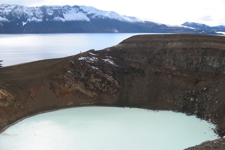
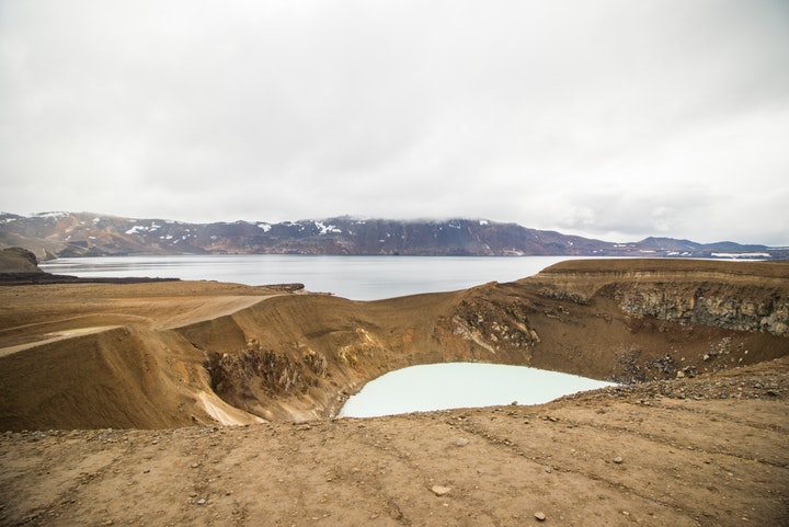
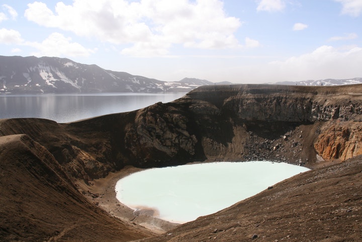
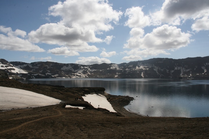
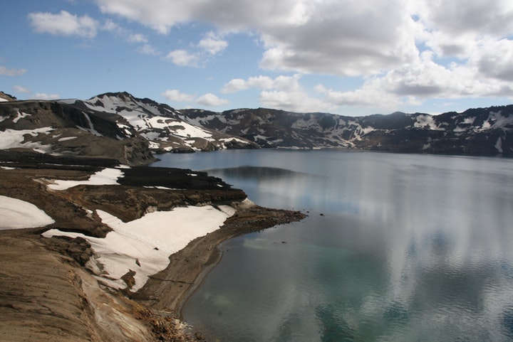
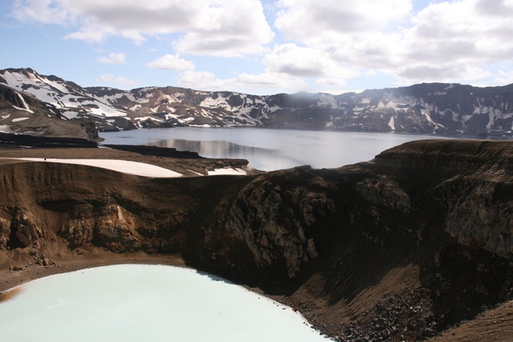
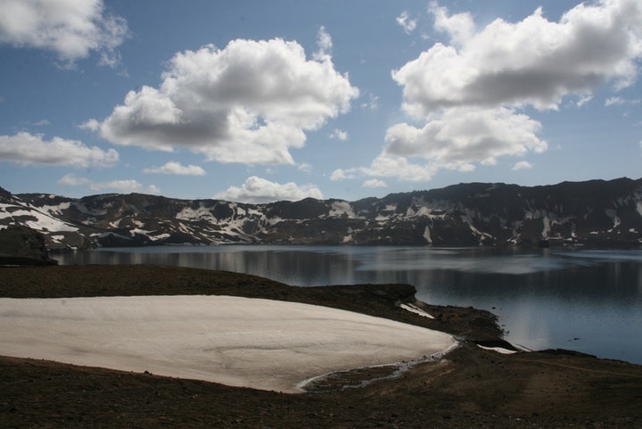
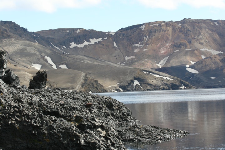
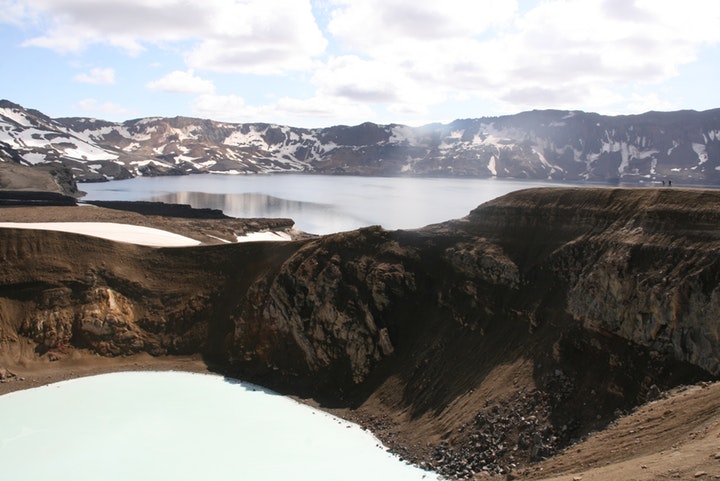
Askja is an enormous caldera and central volcano in the Dyngjufjöll mountains, north of Vatnajökull glacier. The caldera is a bedrock subsidence located above a massive magma chamber, and is still ‘in the making’. Askja was not explored until the nineteenth century, but a series of eruptions in 1874-1875, especially a very powerful explosive eruption in March 1875, caught the attention of the local people as well as scientists. In the massive eruption in 1875, the volcano erupted approximately 2 billion cubic meters of ash and pumice, and a new caldera was formed inside the older one. In the following decades the new caldera was filled with water, and now contains the 11km² Lake Öskjuvatn, which is also one of the deepest lakes in Iceland (220m). The Askja volcano erupted a few times in the 1920s, but the latest eruption was in the autumn of 1961.

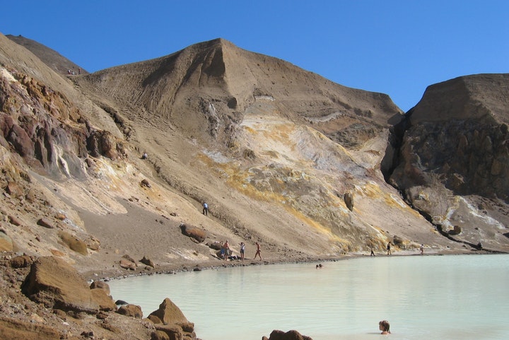
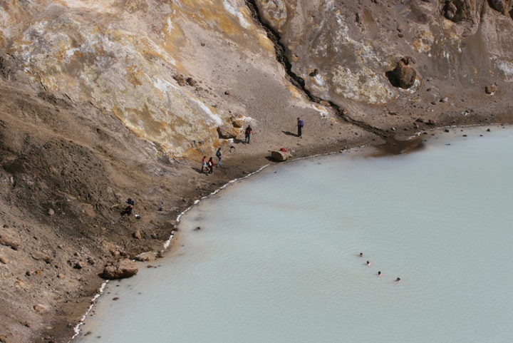
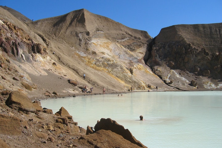
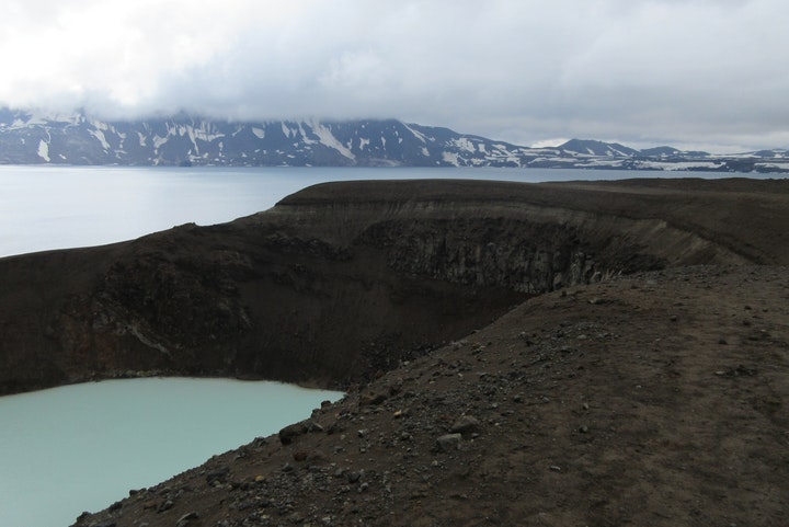
Our bus stops by one of the craters formed in the 1961-eruption. An easy but long 35 minute walk leads you to the rim of Lake Öskjuvatn and the explosion crater Víti (‘Hell’), where travellers seeking unique experience can take a bath in a a milky-blue, warm geothermal lake inside the crater. After enjoying the unearthly quietness and bizarre landscape of Askja our passengers return to the bus and drive back to Lake Mývatn.
Geology
A formidable creation of nature
Where should one go to explore one of the most distinctive and stately representative of Icelandic central volcanoes, ornated with a caldera? To the Dyngjufjöll mountain complex (1,510 m) and Askja. Dyngjufjöll form huge dome-shaped highlands. The structure is a central volcano, built up by repeated eruptions for at least 200,000 years. It is an activity centre in a volcanic system which is 150 km long and 5-10 km wide and termed the Askja Volcanic System. The system represents a true rifting zone volcanic area, located on the margins of two plates that move away from each other at an average rate of 2.0-2.5 cm per year in Iceland. The Dyngjufjöll massif contains three circular depression or calderas. They are hidden from view as one approaches Dyngjufjöll. The main caldera is large (45 sq. km), relatively new (10,000-20,000 years old) and still in the making. It is named Askja. An older, somewhat smaller caldera, is less distinctive in the landscape. The smallest and youngest caldera contains the deepest freshwater lake in Iceland, Öskjuvatn (220 m). The lake basin started to form when an area within the main caldera began to subside as a powerful tephra (ash and pumice) eruption terminated in 1875. The event was a part of a volcano-tectonic epsidode including the lava-producing Sveinagjár eruptions 1874-1875 north of Askja. The lake basin deepened and became filled with groundwater in a few years. The crater Víti formed immediately after the main tephra eruption.
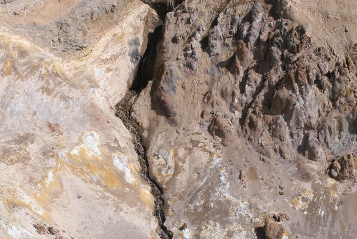
An Askja-type caldera forms above a deep-seated magma source, called a magma chamber, when a part of the roof above the magma mass subsides; sometimes just slowly due to pressure changes in the chamber, but sometimes rapidly during or after volcanic eruptions due to a part of the magma being removed (as in 1875).
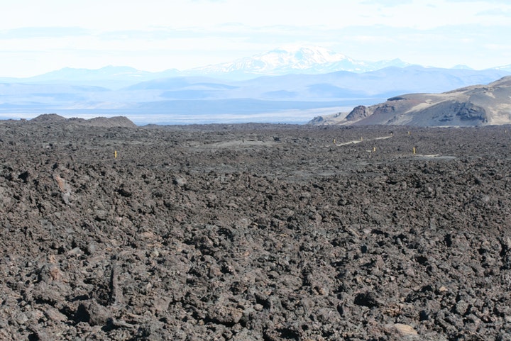
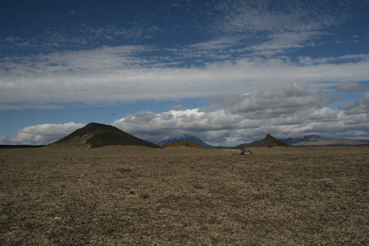
When exploring the Askja Volcanic System the long history of tectonic movements and volcanic eruptions becomes evident but the system has been rather quiet during the better part of the last millennium. Prior to that, enormous tephra eruptions occurred in Dyngjufjöll 10,000-11,000 years ago and numerous lava eruptions then followed. A few lava shields rose in the surrounding lava fields; like the voluminous Kollóttadyngja 1,180 m) which has a volume of 15-20 billion cubic metres. This, along with the associated lava flows, is sufficient to to build a 1,500 to 2,000 km long, 100 m wide and 100 m high wall! The volcanic actvity gradually diminished with time.
In the 20th century, however, a series of eruptions and tectonic events riddled the Dyngjufjöll volcanic centre. Small lava eruptions occurred in the caldera in March 1921, November 1922, December 1922 and in February 1923. In 1924, 1927 and 1927 sightings of eruptions south of Askja were reported in newspapers but no one went to survey the sites. Substantial lava may have flowed somewhat smilar to the lava flows of the Sveinagjár eruptions in the 19th century. In 1926 tephra shot out of Lake Öskjuvatn. A small island crater is still visible in the lake; a small version of the tephra islands that were built during the Surtsey eruption off the south coast almost 40 years later.
After a burst of earthquakes in October 1961, lively solfataras started to erupt in the Öskjuop caldera pass. Around noon on October 26th more earthquakes in Dyngjufjöll were registered and around 14.30 a high eruption cloud rose into the air and was seen from many locations in Northeastern Iceland. An eruption on an 800-1,000 m-long eruptive fissure had already started. The fissure almost lines the caldera fault in Öskjuop. The highest of four lava fountains attained an impressive height of 500 m. The lava discharge was estimated at 600-1,000 cubic metres per second but it soon slowed down. Two large main craters, Austari- og Vestari Borg delivered most of the lava. Today they greet the eye as 20-30 m high and rather wide scoria and spatter cones. In early November, the mode of eruption changed. Lava spatters and shimmering lava ponds illuminated the craters and more lquid ropy lava (pahoehoe), flowing in open channels and tubes, covered the older lava. On the 15th of November, a new crater, Stakaborg, opened up south of Austari- og Vestari Borg, and that crater outlasted the old ones. The eruption was over by the first week of December. The new basalt lava covers an area of 11 sq. km but the volume comes close to 0.1 cubic kilometre (100 million cu. m) and, in addition, some 4 million cu. m. of tephra fell to the ground close to the site. The volcanic fissure is called Vikraborgir and the mixed scoria and the lava flow is called Vikrahraun. The eruption became the first effusive eruption (predominantly lava production) in Iceland that geoscientist could monitor and investigate.
Ari Trausti Guðmundsson
geophysicist.


Dear guests,
Below are a few important points of information for bookings since summer of 2022.
ABOUT THE UPLIFT IN ASKJA
Askja is an active volcano that last erupted in 1961. In August 2021, Askja started inflating after a period of subsidence measured since 1983. As of June 2022, the uplift of the area that is inflating measures around 30 cm. The most likely cause of the uplift is the inflow of magma around 2-3 km below the ground.
In most cases magmatic intrusions do not culminate in volcanic eruptions, and there have been hardly any other signs of an upcoming eruption so far. However, it is important to be aware of potential activity and stay informed about the situation.
So far, the department of Civil Protection has not seen a reason to cease activity and tourism in Askja, but they have declared a state of uncertainty as of September 2021. This means that the situation is being carefully monitored by the Faculty of Earth Sciences, the Icelandic Meteorological Office, and the State Police. As we go to Askja every day, we receive regular updates from these departments, and will also do our part in monitoring and communicating any visible changes or activity in the area.
It is an interesting time in Askja and if you have any questions or want the latest updates regarding the situation, send us an email!
ABOUT YOUR BOOKING
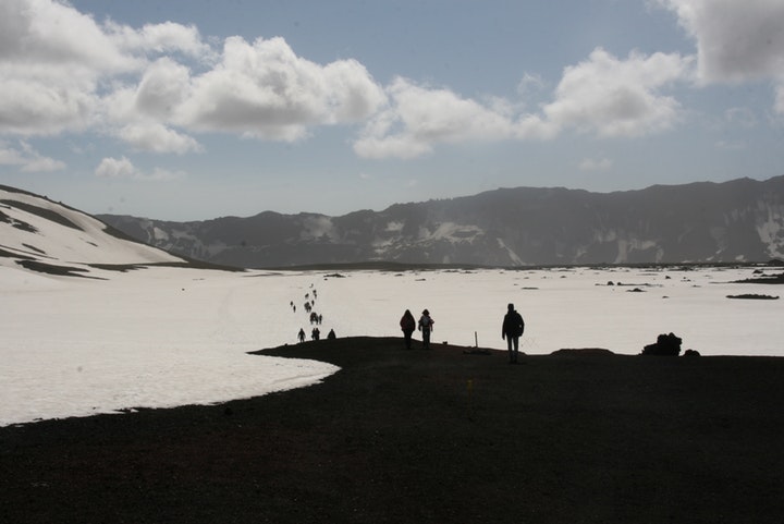
There is a lot of snow in Askja this early in the summer, and the hiking trail is currently covered in snow. The hike to Askja Caldera is around 2.5 kilometres each way on mostly even terrain, but keep in mind that hiking in snow is more difficult and takes a bit longer. Please make sure to bring waterproof shoes and warm clothes.
As for now, it is not recommended to swim in Viti. The PH levels are 1.5, meaning the acidity level of the lake is very high. Temperature of the water is around 14 degrees.
We are used to going every single day over the summer, but on very rare occasions we might need to merge tour dates together if we don’t reach our minimum capacity. If this is the case with your booking, we will reach out to you and offer to move your tour to another date. If your schedule is not flexible, your booking will be fully refunded.
Please note that you can always change your booked date according to our availabilities or receive a voucher from us. If we change your booking and you are not able to join us on our tour at all, we will refund your booking by our policy.
For groups larger than 12 people please contact us directly for your booking requests if your desired departure date is not available on our calendar.
You can book on our website here, or by sending us email myvatntours@gmail.com or phone us +354-861-1920.